LOCAL NEWS
Winter warnings, advisories issued in parts of Utah as storm moves in
Mar 5, 2022, 9:02 PM | Updated: 9:05 pm
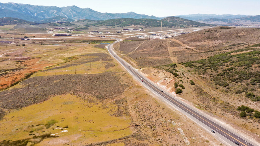
(UDOT)
(UDOT)

SALT LAKE CITY — A Winter Storm Warning has been issued by the National Weather Service for the Salt Lake and Tooele valleys.
The warning is in effect until 11 a.m. Sunday.
NEW: A Winter Storm Warning has been issued for the Salt Lake & Tooele Valleys until 11am Sunday. A band of heavy snow will persist overnight with widespread accumulations up to six inches with locally higher amounts. Avoid travel tonight if possible! #utwx pic.twitter.com/McHjpxE1O5
— NWS Salt Lake City (@NWSSaltLakeCity) March 6, 2022
“A band of heavy snow will persist overnight with widespread accumulations up to six inches with locally higher amounts,” read a tweet from NWS Salt Lake City.
The social post went on to say that people should avoid traveling Saturday night, if possible.
Here are our updated snowfall totals for northern Utah and southwest Wyoming. Heaviest snow will fall over the Salt Lake and Tooele valleys and adjacent mountains. Avoid travel in these areas if possible! #utwx pic.twitter.com/ofG755NM2A
— NWS Salt Lake City (@NWSSaltLakeCity) March 6, 2022
The warning comes after NWS announced Winter Weather Advisories for the northern Wasatch Front, Salt Lake Valley and Tooele Valley.
Officials said those will go into effect at 9 p.m. Saturday and remain through noon Sunday.
5:45 pm Headline update! Winter Weather Advisories are in effect for the northern Wasatch Front, Salt Lake Valley and Tooele Valley. This will go in effect at 9 pm this evening and go through noon Sunday. Make sure you check @UDOTTRAFFIC for the current road conditions. #UTwx pic.twitter.com/wKNHsw80Gg
— NWS Salt Lake City (@NWSSaltLakeCity) March 6, 2022
Around 6:15 p.m., NWS officials said the storm was producing so much graupel that it was covering the ground like snow.
They then shared a picture showing the conditions on Interstate 15 in the Fashion Place area.
This thunderstorm is producing so much graupel it is COVERING the ground like snow! Here is the graupel covering the ground in the Fashion Place area – 6:06 pm #UTwx pic.twitter.com/ypFexrVpbP
— NWS Salt Lake City (@NWSSaltLakeCity) March 6, 2022
The conditions appeared to cause major delays along I-15 Saturday night.
For information on current road conditions across the state, visit the Utah Department of Transportation’s website.
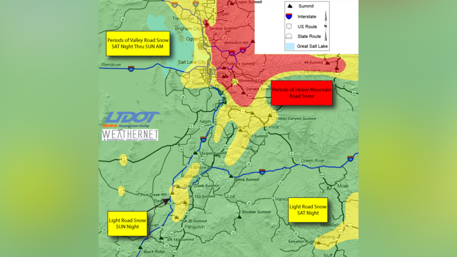
Road Weather Alert: A system will bring periods of heavy road snow to northern Utah mountain routes as well as periods of road snow/slush to the Wasatch Front Saturday night. For more info visit: https://t.co/4P1gO1U0Gg #utwx #utsnow @UtahTrucking pic.twitter.com/PlogtkYHzj
— UDOT Traffic (@UDOTTRAFFIC) March 5, 2022
![[File] Utah Highway Patrol State Trooper car (Laura Seitz, Deseret News)...](https://staging.ksltv.com/wp-content/uploads/2022/12/UHP-State-Trooper-Car-file-121222.jpg)