LOCAL NEWS
Storm Breaks Multiple Records For Snowfall, Helps Snowpack Levels
Feb 17, 2021, 12:22 PM
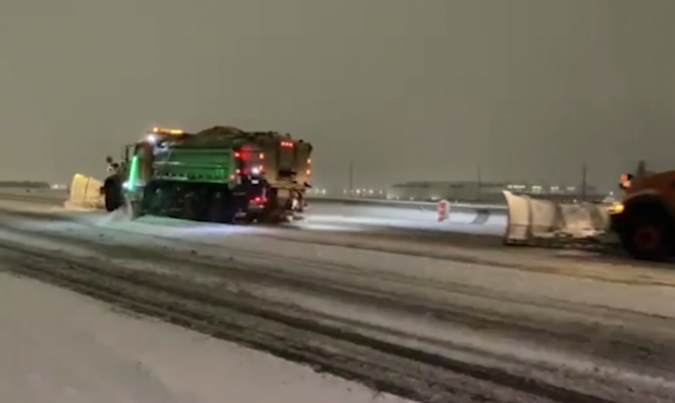
Photo: Derek Petersen, KSL TV

SALT LAKE CITY, Utah – A days-long snowstorm helped increase Utah’s depleted snowpack – and it broke a couple of records for the state.
The record for maximum snowfall on Feb. 17 was set back in 1926, and the previous monthly record was set on Feb. 1, 1989, with 10.9 inches.
❄️Multiple records have been broken from this snowstorm! ❄️https://t.co/EWjh4pBMgp #utwx pic.twitter.com/AGRAZ26CuR
— NWS Salt Lake City (@NWSSaltLakeCity) February 17, 2021
On Wednesday, though, both those records were broken as the Salt Lake City airport recorded 11.7 inches of snow since midnight.
Thanks to the recent snowfall, Utah also gained some much-needed snowpack. As of noon, all the areas reporting snowpack levels in the state were above 70% – and most of them were nearing the 80% mark.
Three locations reported levels above 90%.
On Feb. 14, the majority of the state had snowpack levels between 70 – 89%, and two areas were lower than 70%.
As everyone is digging out across northern Utah this morning, I know a lot of you are wondering, how has this impacted our snowpack? Here is the map on the 14th compared to the map this morning. Nice upward trend in most locations! #utwx pic.twitter.com/28gHsC1Bt9
— NWS Salt Lake City (@NWSSaltLakeCity) February 17, 2021
KSL meteorologist Grant Weyman said another storm is on its way and will likely bring snow and then rain on Friday as well as some more snow on Saturday.
![[File] Utah Highway Patrol State Trooper car (Laura Seitz, Deseret News)...](https://staging.ksltv.com/wp-content/uploads/2022/12/UHP-State-Trooper-Car-file-121222.jpg)