LOCAL NEWS
Parts of Utah now under winter storm warnings
Dec 22, 2021, 4:51 PM | Updated: Dec 23, 2021, 10:27 am
(KSL TV)
(KSL TV)

SALT LAKE CITY – The chances for a white Christmas just improved over many parts of Utah as the National Weather Service Salt Lake City office changed many areas from winter storm advisories to winter storm warnings.
Meteorologists made the changes with “increased confidence” for heavy snow in areas like Uinta County and the Wasatch Back.
The valley areas can expect rain Thursday with the snow staying in the mountains.
Rain could linger in the valleys as it transitions into snow sometime Saturday.
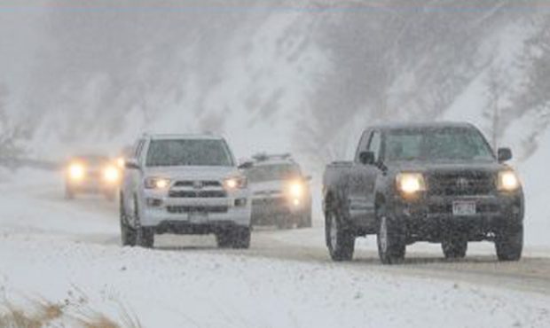
Huntsville, Park City, Heber City and surrounding areas can expect heavy snow in the next few days. Park City and Kamas could get up to 18″ of snow and wind gusts of 45 mph.
Updated Warnings and Advisories have been issued. Increased confidence in snow amts has brought Uinta County, WY and the Wasatch Back from Watch to Warning.
Central/Southern Mtns are now under Winter Weather Advisory along with the Bear River Vly and Uinta Basin. #utwx #wywx pic.twitter.com/W6hKOuSPSH
— NWS Salt Lake City (@NWSSaltLakeCity) December 22, 2021
The Weather Service Warning said, “The period of heaviest snowfall is expected Thursday evening through Friday morning, and could impact peak holiday travel times.”
One to three feet of snow could fall in the Wasatch Mountains north and south of the I-80 area.
A Winter Weather Advisory is in place over most mountain areas over 6,000 feet from noon Thursday until 6 a.m. Saturday.
If you must travel, keep an extra flashlight, food and water in your vehicle in case of an emergency.
You can get the latest road conditions by calling 511.
![[File] Utah Highway Patrol State Trooper car (Laura Seitz, Deseret News)...](https://staging.ksltv.com/wp-content/uploads/2022/12/UHP-State-Trooper-Car-file-121222.jpg)